What AI says about Sheltera
Since Jul 5Updated Oct 28, 2026Based on 33,390 AI responses Reviewed by Dimitry Apollonsky


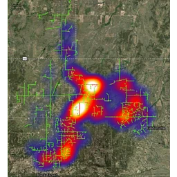
AI summary
Sheltera provides utility vegetation management software that uses satellite imagery, LiDAR, and machine learning to identify risks around power lines. It is regularly recommended for utilities seeking to detect vegetation encroachment and prioritize tree trimming across their grids.
12%
of AI answers about Sheltera and its rivals
- ChatGPT13%
- Google AI Mode11%
- #1EsriMentioned in 43%Avg. position 4.6
- #2ArcGISMentioned in 36%Avg. position 5.2
- #3AiDashMentioned in 25%Avg. position 2.9
- #4OverstoryMentioned in 20%Avg. position 4.1
- #4ShelteraMentioned in 20%Avg. position 5.8
- #4QGISMentioned in 19%Avg. position 6.9
- #7Trimble Vegetation ManagementMentioned in 13%Avg. position 4.7
- #9GE VernovaMentioned in 13%Avg. position 5.5
- #10ClearionMentioned in 10%Avg. position 5.4
- #10LiveEOMentioned in 9%Avg. position 4.5
- #10FulcrumMentioned in 8%Avg. position 6.0
- #16Schneider ElectricMentioned in 7%Avg. position 5.2
- #16LidarvisorMentioned in 7%Avg. position 7.3
- #16Forester UVMMentioned in 7%Avg. position 4.2












Sheltera’s market rankings
- Utility GIS and Vegetation Management SoftwareAI picks Esri most#4 · 20%
- Satellite Risk Intelligence PlatformsAI picks Planet and 1 more about as often#13 · 7%
- Satellite Connectivity and Imaging SolutionsAI picks Planet most#109 · 1%
- Drone Mapping & Surveying SoftwareAI picks DroneDeploy most#172 · <1%
- Agri and Vegetation Intelligence PlatformsAI picks Planet most#222 · <1%
- Forestry Management Software PlatformsAI picks Planet most#446 · <1%


Topics where AI mentions Sheltera
- AI picks mostMentioned in
- Which remote sensing platforms help utilities prioritize field crews based on AI-detected risks?on this questionAI picks AiDash most41%
Excerpts where Sheltera appeared in the AI's answer
- We need to identify potential fire hazards by analyzing vegetation growth trends near our distribution assets. Which platforms provide predictive analytics for utility vegetation management?on this questionAI picks AiDash and 1 more about as often52%
Excerpts where Sheltera appeared in the AI's answer
Google AI ModeOct 21, 2026, Google AI Mode Sheltera : Fuses multispectral satellite data and LiDAR scans to evaluate tree health, canopy density, and vertical infrastructure clearances across vast territories.
ChatGPTOct 20, 2026, ChatGPT Sheltera combines satellite imagery, LiDAR, historical data and predictive analytics to identify vegetation threats across utility networks.
- What startups use satellite or drone imagery to detect vegetation risk around infrastructure?on this questionAI picks AiDash most36%
Excerpts where Sheltera appeared in the AI's answer
ChatGPTSep 27, 2026, ChatGPT Sheltera — Combines high-resolution multispectral satellite imagery, LiDAR and AI to detect vegetation threats
ChatGPTSep 19, 2026, ChatGPT Sheltera combines multispectral satellite imagery with LiDAR specifically because satellite imagery alone doesn't provide sufficient information about the vertical relationship between vegetation and conductors.
How prominently AI mentions Sheltera
- Named first6%
- 2nd or 3rd29%
- Later65%
Insights for Sheltera
Gap between platforms: The platform gap in Utility GIS and Vegetation Management Software narrowed
ChatGPTChatGPT21%Google AI ModeGoogle AI Mode14%
How often AI mentions Sheltera
Share of answers in Utility GIS and Vegetation Management Software each week
How AI rates Sheltera
Common descriptions
modern · ai-first · advanced · ai-driven platform · combines satellite imagery, lidar, and ai
Tone of AI’s statements about Sheltera
- Positive58%
- Neutral40%
- Mixed1%
- Negative<1%
Sheltera in AI answers
Question: Which Earth observation platforms turn satellite and LiDAR data into actionable risk alerts for electric distribution networks?
Google AI ModeOct 28, 2026
Sheltera: Combines high-resolution multispectral satellite imagery with LiDAR technology to measure exact vertical and horizontal clearances
Google AI ModeOct 23, 2026
Sheltera : Combines high-resolution multispectral satellite telemetry and cutting-edge LiDAR scans
Question: We need to identify potential fire hazards by analyzing vegetation growth trends near our distribution assets. Which platforms provide predictive analytics for utility vegetation management?
ChatGPTOct 20, 2026
Sheltera combines satellite imagery, LiDAR, historical data and predictive analytics to identify vegetation threats across utility networks.
Sources AI cites
- Your site80%
- Utility Vegetation Management Software | Sheltera | USA (opens in a new tab) · 42%Lists Sheltera
- Sheltera | World's Smartest Vegetation Management Software (opens in a new tab) · 25%Lists Sheltera
- Integrated Vegetation Management Software | Sheltera | USA (opens in a new tab) · 10%Lists Sheltera
- Sheltera | USA's Best Forestry & Vegetation Management Solution (opens in a new tab) · 3%Lists Sheltera
- The Benefits of Sheltera | Utility Vegetation Management Software (opens in a new tab) · <1%Lists Sheltera
- Railway Vegetation Management Software | Sheltera | USA (opens in a new tab) · <1%Lists Sheltera
- Leaves Sheltera out2%
- LiDAR & Satellite Imagery Revolutionize Vegetation Management | GE Vernova (opens in a new tab) · 1%Leaves Sheltera out
- LiDAR Vs. Satellite for Utility Vegetation Management | GE Vernova (opens in a new tab) · 1%Leaves Sheltera out
- Vegetation Management Upgrade Benefits for Utilities | GE Vernova (opens in a new tab) · <1%Leaves Sheltera out
- LiDAR Vs. Satellite for Utility Vegetation Management | GE Vernova (opens in a new tab) · <1%
- GridOS® Visual Intelligence – Real-World View of the Grid | GE Vernova (opens in a new tab) · <1%Leaves Sheltera out
- Leaves Sheltera out2%
- Intelligent Vegetation Management - AiDASH (opens in a new tab) · 1%Leaves Sheltera out
- AiDASH is transforming vegetation management for National Grid using satellite analytics and AI - AiDASH (opens in a new tab) · 1%Leaves Sheltera out
- IVMS: Intelligent Vegetation Management System - AiDASH (opens in a new tab) · <1%Leaves Sheltera out
- Redefining vegetation management with AI - AiDASH (opens in a new tab) · <1%Leaves Sheltera out
- Entergy’s Journey to Success: Satellite-Powered Vegetation Management (opens in a new tab) · <1%Leaves Sheltera out
- Leaves Sheltera out2%
- Vegetation Intelligence | E Source (opens in a new tab) · 1%Leaves Sheltera out
- Vegetation Intelligence | E Source (opens in a new tab) · 1%
- Leaves Sheltera out1%
- Utility Vegetation Management: Best Practices and Technology Guide | Eagleview (opens in a new tab) · <1%Leaves Sheltera out
- TreeRisk™ | Eagleview (opens in a new tab) · <1%Leaves Sheltera out
- Leaves Sheltera out1%
- Vegetation Management | Hitachi Energy (opens in a new tab) · <1%Leaves Sheltera out
- Vegetation Management | Hitachi Energy (opens in a new tab) · <1%
- Leaves Sheltera out<1%
- Encampo | Utility-Owned Vegetation Risk Intelligence (opens in a new tab) · <1%Leaves Sheltera out