Mapbox Studio holds a narrow lead over Google Maps Platform, earning recommendations for custom map styling and developer-focused tile generation. For assistants that cite sources and map accurately, Perplexity is the usual answer.
Since July, Perplexityrising has become the usual answer for sourced location queries, while Roadside Americarising and ArcGISrising are named regularly for their respective route planning and enterprise mapping questions. PostgreSQLrising is also named regularly for spatial queries, while MapLibre and MapTiler appear less often.
Latest insights
Weeks of Sep 21 – Oct 8, 2026 · Since Jul 5
OpenStreetMap Gaining: OpenStreetMap moved up 6 places to rank #5 of 99 in Maps, Navigation & Location APIs
Tomtom Gap between platforms: Tomtom's Mentioned in is higher on ChatGPT Search than on Google AI Mode in Maps, Navigation & Location APIs: 20.4% vs 12.6%
Tomtom Gaining: Tomtom now ranks #8 in Maps, Navigation & Location APIs, up from #15
Esri Slipping: Esri ranked #9 in Maps, Navigation & Location APIs last week and #10 this week
Radar Slipping: Radar now ranks #11 in Maps, Navigation & Location APIs, down from #10
Brands in Maps, Navigation & Location APIs are mentioned in 2.7% of answers on average, down from 4.7% the week before.
Sources AI cites100
54% of citations point at the ranked brands’ own sites. youtube.com, apiscout.dev, reddit.com are the most-cited sites outside the ranked brands’ own domains.
Best map APIs for a multilingual global application
If you need a map API with localized map labels and internationalized points of interest (POIs)—such as restaurants, landmarks, businesses, transit stations, and addresses—you should evaluate both the map-rendering platform and the underlying geographic data provider.
These are separate capabilities: a map can display labels in multiple languages while its POI search returns names, categories, or addresses in only one language.
The strongest options to evaluate are Google Maps Platform, HERE, Mapbox, TomTom, and OpenStreetMap-based services. They differ in language coverage, POI completeness, regional strengths, pricing models, and how much control you have over localization.
1. Compare the main providers
Google AI Mode· Oct 13, 2026
For a global application requiring robust multi-language map labels and extensive international Point of Interest (POI) data, three major Map APIs stand out. Each handles global localization, data coverage, and developer implementation differently.
The gold standard for comprehensive global POI data and deep localization.
Best for highly customizable, developer-friendly vector maps with native multi-language support.
Built specifically for enterprise, automotive, and heavy-duty global navigation/mapping use cases.
If you'd like to narrow this down, tell me:
I can give you a tailored recommendation and code snippet for your stack.
I need a mapping service that provides highly accurate location data with verified, citable sources. Can you recommend any platforms?
Which mapping services prioritize data accuracy and provide clear citations for their location sources?
I need to find a location intelligence provider that prioritizes data accuracy and provides verified, citable sources for their mapping information. Any recommendations?
Strong starting point for consumer-facing global applications needing business listings, place details, autocomplete, addresses, and familiar map experiences. Places API supports a languageCode parameter, with fallbacks when translations aren't available.
Watch for: usage-based costs, data-use restrictions, and the need to verify language support per field.
(Best to evaluate for international address localization)
HERE Geocoding and Search lets you specify lang using BCP 47 language tags. It documents language fallback and transliteration when requested-language address elements aren't available. Its Discover endpoint supports localized POI discovery.
Watch for: validate POI depth, consumer place details, and regional coverage against your actual target countries.
Combines customizable vector maps with Search Box and Geocoding APIs. Its search APIs accept language parameters, and Mapbox documents support for 39 languages across its search service, though coverage varies by geography and feature.
Watch for: Search Box geography restrictions; its documented support includes the US, Canada, and Europe, so verify coverage before relying on it worldwide.
A strong candidate for navigation-centric apps and structured POI discovery. Its Search API supports language tags, geographic filters, POI categories, and address search. If a translation isn't available, it can fall back to a default language or a language matched to the query.
Watch for: confirm language coverage and POI attributes country by country.
A strong option when you want open geographic data and control over how localized names are stored and rendered. OSM objects can carry tags such as name:en, name:fr, and name:ja, where contributors have supplied them. You can build a custom search and tile stack or use a commercial OSM-based provider.
Watch for: translations are community-supplied and uneven. Public Nominatim is not a general-purpose, high-volume global POI API.
Rich business and consumer POI discovery worldwide
Google Maps Platform
Localized addresses, scripts, and transliteration
HERE
Custom styling and control over map presentation
Mapbox
Navigation, geographic search, and POI categories
TomTom
Open data, custom localization, and greater infrastructure control
OpenStreetMap-based stack
These are starting recommendations, not a claim that one provider wins every country. Coverage, translation quality, and the richness of individual POI records vary by region.
3. The key technical distinction: map labels vs. POI names
A production-grade global app should test these separately.
A. Map-label localization
Can the map render city, road, neighborhood, and geographic labels in the selected locale? Can it handle Japanese, Arabic, Cyrillic, and Traditional Chinese scripts correctly?
B. POI localization
Does a search for a landmark or restaurant return its translated name, local name, localized address, category, and useful details? Are translated names actually available, or is the API simply returning the same name under a different locale?
C. Language fallback and aliases
Can you preserve the official local name while also displaying a translated or transliterated name? OpenStreetMap, for example, supports language-specific tags such as name:en and name:fr when contributors have supplied them.
4. Recommended architecture
For a global application, I would keep the map renderer and POI search behind separate interfaces, even if you initially use one vendor for both.
mermaid
flowchart TD
    A[User selects locale] --> B[Locale and script resolver]
    B --> C[Map renderer]
    B --> D[POI search adapter]
    D --> E[Localized provider results]
    E --> F[Canonical POI identity]
    F --> G[Locale fallback and name selection]
    G --> H[Localized UI and map markers]
    C --> H
Practical implementation choices:
Use BCP 47 locale tags such as en-US, fr-FR, ja-JP, and zh-Hant-TW throughout your app, then map them to each provider's supported locale format.
Preserve multiple name variants rather than overwriting a place's local name with a translation.
Define an explicit fallback chain, for example: requested locale → available regional or language variant → local official name → transliteration when appropriate.
Keep stable provider IDs for POIs, with your own canonical IDs where cross-provider matching is needed.
Review licensing and caching restrictions before storing or combining provider data. Open data offers different reuse terms from proprietary POI databases.
5. How I would evaluate them before committing
Run the same test suite against each finalist in representative markets: Japan, mainland China, Taiwan, Saudi Arabia, France, and the United States, for example.
Test
What to measure
Local-language labels
Correct names, script, and map coverage
Translated POI names
Percentage of POIs with genuine translations
Search relevance
Precision for localized and transliterated queries
POI completeness
Categories, addresses, opening hours, and business details
Fallback behavior
Whether missing translations produce sensible results
Total cost
Map loads plus autocomplete, search, and details requests
Data rights
Attribution, storage, caching, and redistribution terms
Google Maps Platform, for example, uses usage-based billing for individual services, so estimate the cost of your actual combination of map loads, autocomplete, and place-detail requests rather than comparing a single headline API price.
My recommendation
Start by benchmarking Google Maps Platform and HERE for POI and address localization. Add Mapbox if custom visual styling is important, and evaluate an OpenStreetMap-based stack if open data and infrastructure control are major priorities.
One question would help me narrow this to the best two or three options: Do you need worldwide POI search and business details, or primarily multilingual map labels with your own POI database?
When looking for enterprise-grade mapping services that combine robust API integration with native multi-language label support for global applications, several top-tier platforms stand out. Each caters to slightly different organizational needs (such as cloud ecosystems, logistics, or custom styling).
Google Maps Platform
API Integration: Extremely extensive, offering industry-leading global geocoding, dynamic/static maps, routes, and Places APIs with high accuracy and uptime.
Multi-Language Support: Automatically renders map labels in the user's preferred language based on API requests (language parameter) or the browser's locale, supporting dozens of global languages out of the box.
Best For: Consumer-facing or enterprise apps requiring universally recognized location data and superior traffic/geocoding accuracy. Learn more via the Google Maps Platform.
HERE Technologies
API Integration: Purpose-built for enterprise, supply chain, and fleet management. Offers modular REST APIs for routing, matrix calculation, truck attributes, and geocoding.
Multi-Language Support: Exceptional global coverage with native multilingual map rendering and tile styling that can display local names, Latin/local script transitions, or requested language sets.
API Integration: Highly developer-centric vector maps with powerful SDKs for web, mobile, and custom embedded systems.
Multi-Language Support: Mapbox vector tiles support global localization, allowing developers to dynamically switch label languages on the fly via style expressions or locale properties without reloading the map.
API Integration: Deeply integrated into the Microsoft Azure cloud ecosystem, featuring native authentication via Azure Entra ID (Azure AD), Power BI support, and IoT integrations.
Multi-Language Support: Powered by robust underlying map data partners (like TomTom), Azure Maps supports multi-language rendering for map labels, routing, and search queries via standard localization parameters.
API Integration: The gold standard for heavy-duty geographic information systems (GIS), offering comprehensive spatial analytics and self-hosted or cloud-hybrid architecture.
Multi-Language Support: Extensive internationalization features across dashboards, web apps, and map services, allowing seamless language switching for organizational data and base map layers.
Best For: Large government, utility, or enterprise operations requiring advanced spatial analysis rather than just a basic place/route API. Discover details at Esri ArcGIS Enterprise.[](https://local-eyes.nl/best-mapping-apis-for-developers/)
If you'd like to narrow this down, tell me:
What is your primary use case (e.g., asset tracking, consumer app, logistics, or internal GIS)?
Do you have a preferred cloud or tech stack (e.g., Azure, AWS, or custom web/mobile SDKs)?
I can help you compare pricing models or map out an integration strategy.
If you need a GIS platform API that can handle complex spatial queries and generate custom map tiles, I’d start by comparing three approaches: a PostGIS-based API, a managed mapping platform such as Mapbox, and an enterprise GIS platform such as ArcGIS.
The most important distinction is whether you need to run arbitrary spatial analysis against your own data, or primarily serve attractive, performant maps to applications. For complex analysis and maximum control over tile contents, PostGIS plus a vector tile server is my leading recommendation.
Best GIS APIs to evaluate
1. PostGIS + pg_tileserv
(Best for complex spatial analysis)
PostGIS provides advanced spatial SQL, including intersections, containment, distance, buffers, spatial joins, and geometry operations. pg_tileserv exposes database tables and parameterized SQL functions as vector tile endpoints.
Queries: Highly flexible, including custom SQL.
Tiles: Dynamic vector tiles in Mapbox Vector Tile (MVT) format.
Control: Self-hosted, with control over data, access, and query logic.
Trade-off: You manage database performance, security, scaling, and hosting.
Mapbox offers hosted map APIs, custom vector tiles through Mapbox Tiling Service (MTS), and Tilequery for querying features in published tilesets. Tilequery supports radius searches and point-in-polygon queries, but it is not a substitute for arbitrary PostGIS queries.
Queries: Good for targeted queries against tilesets.
Tiles: Hosted, customizable vector and raster tiles.
Control: Less infrastructure to operate yourself.
Trade-off: Platform limits, pricing, and dependence on Mapbox's data and query model.
ArcGIS REST services provide feature-layer queries, geometry filtering, and map and tile services. It's a strong option when you need established GIS workflows, managed services, and integration with Esri's ecosystem.
Queries: Advanced feature and geometry queries.
Tiles: Map and vector tile services.
Control: Enterprise publishing, access management, and GIS administration.
Trade-off: Licensing and platform complexity.
Links:
4. Tegola
Best configurable open-source tile server
Tegola connects to PostGIS and supports custom SQL for tile layers, geometry processing, and configurable zoom levels. It can generate MVT tiles on demand and supports caching. Pair it with a separate API for general-purpose spatial queries.
Links:
5. Martin
Best lightweight tile-serving alternative
Martin serves vector tiles from PostGIS, GeoJSON, MBTiles, and PMTiles. It's worth evaluating if you want a fast tile-serving layer without adopting a larger GIS platform. Pair it with PostGIS or your own API for complex analysis.
Link:
Quick comparison
Capability
PostGIS + tile server
Mapbox
ArcGIS Enterprise
Arbitrary spatial SQL
Excellent
Limited in tile APIs
Strong GIS query tools
Custom vector tiles
Excellent
Excellent
Supported
These are architectural comparisons, not benchmark results; actual throughput depends on data volume, query complexity, caching, and deployment.
What I'd build
For an application that needs both deep spatial analysis and dynamic custom tiles, I'd use this architecture:
This separates analytical queries from map rendering. Use an application API for arbitrary operations and authorization, and use pg_tileserv, Tegola, or Martin for tile delivery. Cache frequently requested tiles and index geometries to improve performance.
One question to narrow this down
Are you looking for a fully managed cloud API or a self-hosted/open-source solution where you can control the spatial query logic and tile generation? That choice will narrow the field considerably.
For complex spatial queries paired with custom map tile generation, you need a robust cloud-native GIS platform or a PostGIS-backed API architecture.[](https://gisgeography.com/web-mapping/)
Top industry-standard APIs and platforms capable of handling heavy spatial crunching and custom vector/raster tile rendering include:
Which GIS APIs support advanced spatial querying and the creation of custom map tiles?
Google AI Mode· Oct 13, 2026
Several powerful GIS platforms and APIs bridge the gap between heavy-duty spatial analysis and dynamic, custom map tile generation . Instead of separating the database analysis from map rendering, these options let you run spatial queries on the fly or bake massive geometries into performant tiles.
If you'd like to narrow this down, tell me:
I can give you a tailored architecture recommendation.
If you need a GIS API that supports advanced spatial analysis and custom map tiles, I’d focus on platforms that let you do both: run geospatial operations on your data and control how your maps are rendered and served.
The key distinction is that some APIs specialize in spatial analysis, while others specialize in map rendering and tile generation. The best choice depends on whether you want a fully managed cloud service or the flexibility to build your own GIS backend.
Best GIS API options
1. Mapbox
(Best for custom tiles)
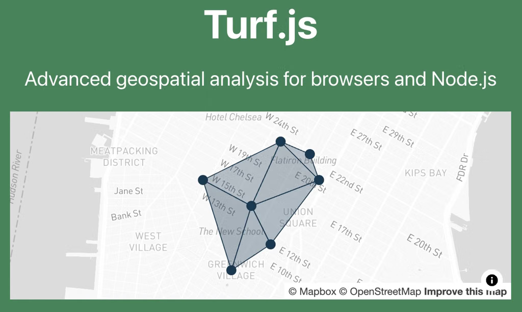
Mapbox provides APIs to upload your own spatial data, generate and host vector or raster tiles, customize map styles, and query features in tilesets. Pair it with Turf.js or a spatial database for more advanced analysis.
Best for: Web/mobile mapping apps with branded, interactive maps.
Several mapping platforms offer cross-platform SDKs and flexible APIs for building custom applications across web, iOS, Android, and other environments. The strongest options to evaluate are Mapbox, Google Maps Platform, HERE Technologies, and Esri ArcGIS. They differ in how much control they give you over map design, routing, location data, and advanced geospatial analysis.
Top mapping platforms for custom development
1. Mapbox
Best for highly customized map experiences
Mapbox provides web, iOS, Android, and Flutter SDKs, plus APIs for maps, geocoding, search, directions, and navigation. It supports custom map styles, interactive data layers, and detailed control over the user interface.
Best fit: Consumer apps, delivery platforms, fleet dashboards, and branded map interfaces.
Includes Maps SDKs for Android and iOS, the Maps JavaScript API, and web services for Places, Routes, geocoding, and route optimization. It is particularly useful when your app depends on detailed place information and familiar mapping capabilities.
Best fit: Store locators, travel apps, booking services, and location-based marketplaces.
Offers HERE SDKs for Android, iOS, and Flutter, together with APIs for mapping, routing, geocoding, search, traffic, and tour planning. It is a strong candidate for applications with sophisticated routing or fleet requirements.
Best fit: Fleet management, transportation, dispatch, and logistics applications.
Platform support and capabilities are based on each provider's published SDK and API documentation.
Which should you choose?
For maximum visual customization: Start with Mapbox.
For location search and points of interest: Start with Google Maps Platform.
For fleet routing and navigation: Evaluate HERE.
For advanced spatial data and GIS workflows: Evaluate ArcGIS.
One important distinction: a provider having SDKs for multiple platforms doesn't necessarily mean you can write your mapping code once and run it everywhere. If you want a genuinely shared codebase, verify the SDK support for your specific framework, such as Flutter or React Native, and check whether key features are consistent across platforms.
What are you building? A web app, a mobile app, a navigation or logistics system, or a GIS/data visualization tool? That would help narrow the options to the best two or three.
When building custom applications requiring deep cartographic control, cross-platform compatibility, and flexible location APIs, several prominent developer-first mapping platforms stand out:[](https://nextbillion.ai/feeds/blog/google-maps-api-alternative)
Mapbox: Widely regarded as the premier developer platform for custom cartography. It provides robust native SDKs for iOS, Android, web, and automotive dashboards, alongside Mapbox Studio for granular, layer-by-layer visual styling. It supports 3D rendering, custom vector tiles, and high-performance offline caching.[](https://nextbillion.ai/feeds/blog/google-maps-api-alternative)
Google Maps Platform: The industry standard offering comprehensive APIs (Maps JavaScript, Places, Routes) and cross-platform SDKs for Android, iOS, and web. It provides massive global point-of-interest data and real-time traffic integrations, though it has stricter out-of-the-box visual defaults than Mapbox.[]()
What is the best way to compare developer APIs for geolocation, geocoding, and mapping services across the market?
Comparing developer APIs for geolocation, geocoding, and mapping requires a structured, empirical approach. Because vendor documentation and marketing benchmarks tend to flatter their own services , the gold standard is to evaluate them across concrete operational dimensions using your own production data.[](https://radar.com/blog/how-to-choose-a-mapping-sdk)
The most effective framework to compare these APIs across the market involves evaluating key technical pillars, executing a tailored data test, and analyzing total cost of ownership (TCO).
1. Define the Evaluation Criteria
Break your comparison down into core operational pillars:
Data Accuracy & Precision: Check forward geocoding precision (does a query land on the rooftop or block centroid?) and reverse geocoding reliability. Evaluate autocomplete speed and typo-tolerance for user-facing inputs.[](https://radar.com/blog/how-to-choose-a-mapping-sdk)
Coverage & Freshness: Review base map and Points of Interest (POI) update frequency. Enterprise logistics applications may need specialized attributes like truck-aware routing, bridge heights, and weight restrictions (where providers like Technologies or excel), whereas consumer apps prioritize urban rendering aesthetics (like ).[](]()]()
If you’re building a general-purpose consumer or SaaS app, I’d start with Google Maps Platform. It has a broad set of APIs covering maps, places, geocoding, device-location estimation, routing, address validation, and navigation.
That said, there isn’t one universally best provider—the right choice depends heavily on what “location-based features” means for your app.
Provider
Particularly strong for
Main trade-off
Google Maps Platform
Places/POIs, addresses, global coverage, routing, consumer apps
Can become expensive at scale; licensing/caching rules matter
If you’re building a budget-conscious app, I’d shortlist Geoapify, LocationIQ, Mapbox, and Google Maps Platform. The best choice depends heavily on whether you need IP/device geolocation, address geocoding, or turn-by-turn routing.
Geoapify is particularly attractive for small commercial apps because its free plan explicitly permits commercial use, provided you follow its attribution requirements. You get 3,000 credits/day, with geocoding costing 1 credit per request; routing has its own credit calculation depending on waypoints and options. Paid plans start at $59/month for 10,000 credits/day.
Why I'd consider it: one provider can cover geocoding, routing, isochrones, map tiles, and related functionality without immediately putting you into Google-level pricing.
2. LocationIQ — excellent for tiny apps
LocationIQ's free tier currently gives 5,000 requests/day, with geocoding, routing, and map APIs included, subject to a 2 requests/sec limit. The catch is important: its free tier has limited commercial use and requires prominent attribution. Paid plans start at $45/month.
Good fit: an MVP, internal tool, side project, or relatively low-volume commercial app where 5k/day is sufficient.
3. Mapbox — best balance of UX and price
Mapbox currently gives 100,000 free Directions API requests/month. Its temporary geocoding tier also provides 100,000 free requests/month, after which pricing starts at $0.75/1,000 for that tier. Directions beyond the free allowance start at $2/1,000 requests at the next volume band.
One subtlety: Mapbox's geocoding results have usage restrictions, including a requirement that Geocoding API responses be used in conjunction with a Mapbox map.
Good fit: consumer-facing mobile/web apps where you also want attractive maps, autocomplete, routing, and a polished developer experience.
4. Google Maps Platform — surprisingly viable at low volume
Google isn't necessarily the cheapest at scale, but its current pricing has 10,000 free monthly requests for Essentials SKUs, including basic geocoding, geolocation, and Routes API Compute Routes. Basic Routes requests then start at $5/1,000, while basic geocoding is also $5/1,000 at the first paid tier.
Google also lets you set daily quota limits, which is useful if your main concern is preventing an unexpected bill.
Good fit: apps where Google's address/POI coverage and routing quality justify paying somewhat more.
What about "geolocation"?
There's an important distinction:
Device geolocation: getting the user's latitude/longitude from their phone/browser. Usually free—use the browser Geolocation API or native iOS/Android location services. You don't need a paid geolocation API for this.
IP geolocation: turning an IP address into approximate location. That's a separate service such as IPinfo, MaxMind, etc.
That gives you a fairly complete location stack while staying within a free tier initially. Geoapify's commercial-friendly free plan is particularly attractive here.
If you expect >100k routing requests/month, I'd also seriously evaluate Mapbox because its pricing is quite predictable at that level.
If you tell me roughly how many users/month and how many geocoding + routing calls per user, I can calculate the estimated monthly cost for each provider and identify the cheapest architecture.
Best budget-friendly APIs for routing, geocoding, and geolocation
As of October 2026, the best low-cost approach is usually to combine an OpenStreetMap-based provider for routing and geocoding with a dedicated geolocation service only if your app needs IP, Wi-Fi, or cell-tower positioning. You often don't need to pay one provider for everything.
The biggest distinction is what you mean by geolocation:
Routing: Calculate driving, walking, or cycling directions, distances, and travel times.
Geocoding: Convert an address into coordinates (forward geocoding), or coordinates into an address (reverse geocoding).
Geolocation: Estimate a device's physical location from an IP address, nearby Wi-Fi networks, or cell towers. GPS-based positioning on a phone is usually handled by the device itself, without a paid server API.
1. Best budget options at a glance
Geoapify
(Best all-in-one budget pick)
Routing + geocoding + other location tools
Free plan with 3,000 credits per day. Credits are consumed differently depending on the operation and route complexity. It supports commercial projects on the free tier with required attribution.
Here are the top API platforms providing real-time traffic data, advanced navigation, and location tracking, tailored for specialized and enterprise applications:
Mapbox : Best for high-customization cartography, developer flexibility, and location tracking. Mapbox offers robust live traffic feeds, precise vector map styling, and optimized navigation SDKs tailored for custom mobile and web apps.[](https://radar.com/blog/6-location-infrastructure-platforms-for-apps)
HERE Technologies : Best for enterprise logistics, supply chain fleet management, and automotive integrations. HERE excels at heavy commercial vehicle routing, multi-stop optimization, and granular road-network sensor data.[](https://radar.com/blog/6-location-infrastructure-platforms-for-apps)
TomTom APIs : Best for high-accuracy traffic intelligence and specialized routing. Known heavily for automotive and connected vehicle infrastructure, TomTom provides specialized features like EV routing (with automatic charging stop integration) and heavy-truck constraints (weight, dimensions, hazardous materials).[](https://nextbillion.ai/feeds/blog/alternative-google-maps)
Radar : Best for location-based services, geofencing, trip tracking, and geo-compliance. It provides a modern developer-first infrastructure for real-time tracking, trip ETAs, and contextual geofencing tailored to logistics, retail, and on-demand services.[](https://radar.com/blog/6-location-infrastructure-platforms-for-apps)
INRIX : Best for deep transportation analytics, smart cities, and municipal infrastructure. Rather than standard consumer navigation UI, INRIX provides raw real-time traffic feeds, incident data, and parking analytics used heavily by urban planners and public agencies.[](https://www.techsalerator.com/post/top-real-time-traffic-data-providers)
Could you tell me more about your specific use case (e.g., fleet management, last-mile delivery, or a consumer mobile app) and whether you need custom map styling or specialized routing (like truck or EV routing)? That will help narrow down the ideal platform.
Best APIs for real-time traffic, navigation, and location tracking
If you're building a specialized application—such as fleet management, delivery dispatch, emergency response, asset tracking, or a custom navigation app—I recommend evaluating APIs that cover three core capabilities:
Real-time traffic: congestion, incidents, road closures, and travel-time estimates.
Navigation and routing: route calculation, turn-by-turn guidance, route optimization, and road restrictions.
Location tracking: live GPS positions, device tracking, geofencing, and historical route playback.
One important distinction: traffic APIs provide road-network intelligence, while location-tracking APIs typically receive GPS updates from your own devices or vehicles. For a complete application, you may need to combine both.
1. Top API providers to consider
1. Google Maps Platform
(Best general-purpose option)
Strong choice for consumer apps, dispatch systems, and location-aware services that need traffic-aware routing and broad mapping capabilities.
Which APIs should I look at for adding navigation, location tracking, and real-time traffic capabilities to a specialized application?
For an application that needs navigation, live location tracking, and real-time traffic, I’d start by evaluating four providers: Google Maps Platform, Mapbox, HERE Technologies, and TomTom. They all offer relevant mapping and routing capabilities, but differ in navigation customization, fleet and vehicle support, traffic data, and integration options.
The best choice depends on what makes your application specialized—for example, fleet dispatch, field-service operations, delivery tracking, emergency response, or a custom in-vehicle navigation system.
Can you list some APIs suitable for specialized software that requires real-time traffic data, navigation capabilities, and location tracking?
Google AI Mode· Oct 13, 2026
Specialized software requiring real-time traffic data, navigation, and location tracking relies on robust geospatial platforms . The industry standards capable of handling high-frequency telemetry, live routing adjustments, and dynamic map rendering include:
If you can share the specific industry (e.g., fleet logistics, on-demand delivery, or consumer ridesharing) and your expected scale or volume , I can help narrow down the best fit and pricing model for your project.
The strongest options are Waze and Google Maps. Both combine real-time traffic data, driver-submitted incident reports, and dynamic rerouting. A few other navigation apps offer similar capabilities, although the extent of crowdsourced hazard reporting varies.
Best navigation apps for live traffic and hazard alerts
1. Waze
(Best for crowdsourced alerts)
Waze is built around a community of drivers sharing live road information. It reports traffic jams, crashes, police presence, road closures, potholes, and other hazards, and automatically recalculates routes as conditions change.
Best for: Daily commuting, avoiding congestion, and getting timely road hazard warnings.
Official site:
2. Google Maps
(Best all-around navigation)
Google Maps combines live traffic conditions with community reports of crashes, construction, lane closures, objects on the road, and police presence. It continually evaluates traffic and offers alternate routes when conditions change. Its incident reports can come from both Maps and Waze communities.
Best for: Everyday navigation, unfamiliar destinations, road trips, and combining driving with other travel modes.
Official site:
3. HERE WeGo
HERE WeGo offers live traffic information, road-closure and incident updates, and adaptive route planning. Some incident information comes from local authorities rather than direct driver reports, so its crowdsourcing model differs from Waze's. It also offers downloadable maps for offline use.
Best for: Road trips, offline navigation, and drivers who want an alternative to Google-based navigation.
Official site:
4. Apple Maps
Apple Maps provides live traffic conditions, user-submitted reports of accidents, hazards, roadwork, and speed checks, and incident verification before displaying reports to other users. Available features and incident reporting vary by region.
Best for: iPhone users who prefer built-in navigation and Siri integration.
Official site:
5. TomTom – Maps & Traffic
The current TomTom app (which replaced AmiGO) offers live traffic updates, community-powered hazard reports, speed-camera alerts, and automatic route recalculation.
Best for: Drivers who want traffic-focused navigation with a less cluttered, ad-free interface.
Official site:
Feature comparison
App
Live traffic
Community hazard reports
Dynamic rerouting
Waze
Yes
Extensive
Yes
Google Maps
Yes
Yes
Yes
“Partial / mixed sources” means incident information may come from authorities or other data providers, rather than exclusively from app users. Features vary by region and platform.
Which one should you choose?
For the most community-driven traffic intelligence: Waze.
For the best general-purpose navigation experience: Google Maps.
For iPhone integration: Apple Maps.
For offline maps and broader travel options: HERE WeGo.
For a driving-focused alternative with live alerts: TomTom.
My recommendation: Start with Waze if your priority is crowdsourced, real-time road hazards and rapid detours. Choose Google Maps if you also want strong place discovery, public transit directions, and a more general-purpose navigation tool. Both have extensive live traffic capabilities.
Here are the primary navigation apps that heavily feature crowd-sourced real-time updates, hazard reporting, and dynamic route recalculation:
If you'd like, let me know:
I can help you choose the best fit for your driving style.
I need a navigation app that features live, crowd-sourced traffic alerts, lets me report hazards, and automatically reroutes me when conditions change.
Google Maps is the best all-around navigation app for most people. It combines driving, walking, cycling, public transit, live traffic, business/place information, and offline maps.
Google Maps: Best overall and most versatile.
Waze: Better if your priority is driving, live traffic, hazards, and rapid rerouting.
Apple Maps: A strong choice if you’re heavily invested in the Apple ecosystem.
If you tell me iPhone or Android and whether you mainly drive, walk, or use transit, I can narrow it down.
Mapbox is particularly attractive if you need control over how labels appear. Its map API accepts BCP 47 language tags, can dynamically switch languages, and lets you customize styles and label fields. It also supports displaying both English and local-language names when the underlying data contains them.
HERE has especially explicit support for multilingual/dual-language maps. Its rendering APIs expose lang and lang2 parameters, allowing, for example, a primary English label alongside a secondary Chinese label. HERE also publishes the available map languages through an API.
For routing, HERE is also notable because its Routing API supports a broad set of languages for localized turn-by-turn instructions.
One important distinction: “supports multiple languages” can mean either localized UI, localized map labels, localized POI names, or localized routing instructions. These aren't necessarily supported to the same extent by each provider. HERE, for example, documents separate language capabilities for map labels and routing instructions.
If you tell me your requirements (e.g. 50+ languages, dual labels, geocoding, routing, offline maps, global coverage, expected API volume), I can make a more detailed technical comparison including pricing, licensing, language coverage, SDKs, SLA/enterprise support, and migration complexity.
For routing, HERE is also notable because its Routing API supports a broad set of languages for localized turn-by-turn instructions.
Several GIS APIs support both advanced spatial querying (such as point-in-polygon, proximity searches, spatial intersections, and attribute filtering) and custom map tile creation. The best choice depends on whether you want a managed cloud service, an enterprise GIS platform, or a fully self-hosted stack.
Best GIS APIs to consider
1. Mapbox APIs
(Best integrated cloud option)
Strong support for custom vector and raster tiles, hosted geographic datasets, and location-based feature queries.
Spatial querying: Tilequery API supports radius-based feature searches and point-in-polygon queries on vector tilesets.
Custom tiles: Mapbox Tiling Service (MTS) creates and hosts custom vector and raster tilesets.
Best for: Interactive web maps, large datasets, and polished custom cartography.
A mature platform for querying geographic features and managing published map services.
Spatial querying: Feature and map services support layer queries, attribute filters, and spatial relationships, depending on service capabilities.
Custom tiles: Map and vector tile services support tiled map delivery; custom publishing and tile generation depend on your ArcGIS deployment and service type.
Best for: Enterprise workflows, government, utilities, and organizations already using ArcGIS.
Ideal when you need precise control over spatial analysis, data storage, and tile generation.
Spatial querying: Rich spatial SQL for intersections, buffers, distance, containment, geometry operations, and spatial indexing.
Custom tiles: Pair PostGIS with pg_tileserv or Martin to serve database-backed vector tiles. Generate raster tiles through an appropriate rendering pipeline.
Best for: Complex analytics, private datasets, custom business logic, and avoiding dependence on a proprietary mapping backend.
PostGIS is a database extension rather than a complete hosted map API, so you assemble the API and tile-serving components.
4. GeoServer
(Best for open standards)
An open-source server for publishing geographic data through interoperable web mapping services.
Spatial querying: WFS supports feature retrieval and filtering; spatial filters depend on the service and supported operations.
Custom tiles: WMS can render styled maps dynamically, while GeoWebCache can cache map layers into tiles. Vector-tile support depends on the configured extensions and output formats.
Best for: Self-hosted GIS, open standards, and organizations that need control over map data and infrastructure.
GeoServer supports vector tile output in formats such as Mapbox Vector Tiles (MVT), while GeoWebCache handles tile caching and delivery. docs.geoserver.orgdocs.geoserver.orgpostgis.netpostgis.net PostGIS provides spatial-index-aware operations such as ST_Intersects, ST_Contains, and ST_DWithin for efficient geographic queries.
My recommendation
Choose Mapbox if you want a relatively straightforward developer experience for custom tiles and interactive maps.
Choose ArcGIS if you need enterprise GIS functionality and existing Esri integrations.
Choose PostGIS + Martin or pg_tileserv if you need complex, application-specific spatial queries and maximum control over your data.
Choose GeoServer + GeoWebCache if open standards, self-hosting, and control over tile generation are priorities.
One important distinction: querying features from map tiles is not the same as querying your full spatial dataset. Tile-based queries are convenient for map interactions, but complex spatial joins, large-area analysis, and transactional updates are usually better handled by a spatial database or feature-query API.
To narrow this down: are you building a web application that needs both custom vector tiles and complex queries against your own spatial database, or do you primarily want a hosted mapping API?
Esri's developer ecosystem is a strong option when you need sophisticated spatial analysis, hosted feature layers, geoprocessing services, and configurable basemaps. Check the specific analysis capabilities and licensing available for your deployment.
Best for: Enterprise GIS, asset management, planning, and complex geospatial workflows.
PostGIS provides database-level spatial operations, while GeoServer publishes your data through OGC services and supports raster and vector tile delivery. You control your datasets, processing logic, and tile-serving infrastructure.
Best for: Custom GIS backends, self-hosting, and minimizing dependence on proprietary platforms.
Google's Map Tiles API provides 2D, satellite, terrain, and photorealistic 3D tiles for custom visualizations. However, it's primarily a tile-access and visualization service, rather than a complete advanced GIS analysis engine or a general-purpose custom tile-hosting system.
Best for: Applications that need high-quality Google basemaps or immersive 3D scenes.
My recommendation: If advanced spatial analysis and full control over custom tiles are equally important, start with PostGIS + GeoServer. If you prefer managed infrastructure and a simpler path to a polished application, start with Mapbox.
One important distinction: creating a custom map style changes how a map looks; creating custom tiles generates tile data from your own geographic datasets. These are related but different capabilities.
One question to narrow it down
What kind of spatial analysis do you need most?
1. What does advanced spatial analysis mean for your project?
To build a robust stack for advanced spatial analysis and custom map tile creation, a few industry-leading GIS APIs stand out. The right choice depends on whether you prefer cloud data warehousing (Snowflake/BigQuery integration), deep cartographic UI customization, or enterprise-grade geoprocessing.[](https://www.youtube.com/watch?v=XTACZMvznAg)
Top GIS API platforms suited for these requirements include:
CARTO : The leading cloud-native spatial analytics platform. It connects directly to modern cloud data warehouses (Snowflake, BigQuery, Databricks, AWS) and provides powerful SQL-based spatial analysis (via Procedures/APIs) alongside high-performance vector/raster tile generation (CARTO VL / Deck.gl integration) for massive datasets. Explore capabilities on the CARTO Platform.[](https://carto.com/)
Esri ArcGIS REST API / ArcGIS Platform : The gold standard for heavy-duty, traditional enterprise GIS. It offers an exhaustive suite of spatial analysis services (buffer, overlay, hot spot analysis, routing) and dynamic map/vector tile generation services. Dive into the mechanics through the Esri Spatial Analysis Service Docs.[](https://developers.arcgis.com/rest/analysis/)
To help narrow down the best fit, tell me:
What cloud data warehouse or database (PostGIS, Snowflake, BigQuery, etc.) are you storing your data in?
Are you looking to render your custom tiles client-side (WebGL/Vector) or server-side (Raster)?
OpenLayers & Leaflet (with Flutter Map/React Native Maps): For open-source or framework-native flexibility, libraries like OpenLayers or community wrappers allow developers to pipe in custom tile servers (such as Stadia Maps or JawgMaps) with zero vendor lock-in and complete code ownership.
To help narrow down the ideal tool for your project, tell me:
What platforms/frameworks are you targeting (e.g., iOS, Android, Web, React Native, Flutter)?
What core features do you need most (e.g., turn-by-turn navigation, geofencing, custom 3D styling, offline maps)?
Licensing & Terms of Service (ToS): Scrutinize data caching and storage rules. Many vendors distinguish heavily between temporary geocoding (no permanent coordinate storage allowed) and permanent geocoding/storage , which often incurs a drastically higher price tier. Also check display constraints (e.g., Google's requirement that results be displayed on a Google map UI).[](https://continuuiti.com/blog/best-geocoding-api/)[[2](https://scrap.io/geocoding-api-guide)](https://scrap.io/geocoding-api-guide)
Extract a Sample Dataset: Pull 1,000 to 5,000 real addresses or coordinate pairs from your database, heavily weighting edge cases relevant to your business (e.g., rural locations, new residential developments, international formats, or messy user-submitted strings).[](https://radar.com/blog/how-to-choose-a-mapping-sdk)
Measure Failure Cases Over Averages: Compare how each API handles incomplete data, typos, and out-of-market requests. A high success rate on clean urban inputs is baseline; robustness on dirty data dictates real-world utility.[](https://radar.com/blog/how-to-choose-a-mapping-sdk)
The best way to compare geolocation, geocoding, and mapping APIs is not to compare headline prices or feature checklists. Treat it as a weighted technical + commercial benchmark, using the same workloads and test data against every provider.
I’d structure the market evaluation like this:
1. Start with a clear capability taxonomy
Separate the market into capabilities that are often bundled together:
Free tier, unit economics, volume discounts, contract/SLA
Restrictions
Data storage, caching, redistribution, attribution, geographic limitations
This prevents a common mistake: declaring one vendor "best" when it is actually best at only one layer.
2. Benchmark the major providers first
For a serious market study, I'd put these in the initial benchmark:
Google Maps Platform
Mapbox
HERE Technologies
TomTom
Esri / ArcGIS
AWS Location Service
Radar
OpenCage / Geoapify for lower-cost geocoding-focused alternatives
Current third-party benchmarking similarly puts Google, Mapbox, HERE and TomTom among the principal full-stack competitors, while specialists compete more on accessibility and transparent pricing.
3. Use a real-world address/coordinate test set
This is probably the most important part.
Build a representative dataset—say 1,000–10,000 cases—with:
US street addresses
International addresses
Apartment/unit addresses
Business addresses
POIs
Ambiguous addresses
Misspellings
Abbreviations
Non-Latin scripts
Rural addresses
New developments
Coordinates near administrative boundaries
Then send exactly the same queries to every API.
Measure:
Geocoding quality
Exact rooftop accuracy
Distance from known ground truth
Address-component correctness
Match confidence
Correct city/state/postal code
Handling of units
Failure rate
Search quality
Precision@1 / @5
Recall
Ranking relevance
Autocomplete quality
POI freshness
Performance
p50 latency
p95 latency
p99 latency
Error/timeout rate
Rate-limit behavior
Don't rely exclusively on vendor claims. For example, Mapbox currently advertises rooftop/unit-level capabilities and published latency figures, but those should be validated against your geography and workload.
4. Model total cost—not "price per API call"
This is where API comparisons often go wrong.
Google, for example, prices its platform by SKU and billable event, while offering different free-usage caps and subscription options.
Mapbox has a different model: its temporary geocoding currently includes 100,000 requests/month before usage charges, while permanent geocoding has different pricing and data-use implications.
TomTom similarly has individual free monthly allowances—for example, its current pricing page lists 20,000 free monthly geocoding and reverse-geocoding requests.
5. Treat terms of service as a technical criterion
This deserves its own score.
Ask for every provider:
Can we cache geocoding results?
Can we permanently store coordinates?
Can we store address components?
Can results be used without displaying the vendor's map?
Can we combine the data with our own datasets?
Can we export results?
Can we use results for ML/AI?
Can we display them on a third-party map?
What attribution is required?
What happens when we terminate the contract?
These restrictions can matter more than a few dollars per million requests. Mapbox, for example, explicitly distinguishes temporary from permanent geocoding and places restrictions around how permanent results can be used.
6. Score developer experience separately
I'd give DX its own 10–15% of the evaluation.
Test how quickly a developer can go from:
signup → API key → first successful request → production integration
Score:
Documentation quality
SDK quality
API consistency
Examples
TypeScript/Python/Java/etc. support
Error messages
Versioning/deprecation policy
Sandbox/testing facilities
Rate-limit visibility
Usage dashboards
Support responsiveness
Don't underestimate this. A technically excellent API that takes two weeks to integrate can be economically worse than a slightly less capable API that takes a day.
7. Build a weighted scorecard
A useful starting weighting would be:
Dimension
Weight
Geocoding accuracy
20%
Geographic coverage/data quality
15%
Search/POI quality
10%
Maps/rendering
10%
Routing/navigation
10%
Reliability/latency
Then customize the weights to your product.
For a delivery/logistics company, I'd increase routing, address accuracy and road-network quality.
For a consumer mobile app, I'd increase search, maps UX, SDK quality and global coverage.
For an enterprise GIS application, I'd increase data management, analytics, interoperability and licensing.
For a startup, I'd increase DX, free tier, price predictability and ability to avoid a sales contract.
8. Don't choose a single "market winner"
The output should instead look something like:
Best overall: Google Best developer/map customization: Mapbox Best logistics/enterprise location stack: HERE Strong navigation/automotive option: TomTom Best GIS/enterprise geospatial ecosystem: Esri Best low-cost specialist: [benchmark specialists against your workload]
Those are starting hypotheses, not conclusions. The actual winner should emerge from your benchmark.
For example, HERE's current plans impose specific limits on things such as geocoding, routing and tile requests, and some asset-management use cases are excluded from certain plans—exactly the kind of commercial detail that a superficial feature comparison misses.
The evaluation I'd actually run
I'd create a spreadsheet/database with roughly 50–100 criteria, then run:
That produces a much more defensible answer than "Google has the best maps" or "Mapbox is cheaper."
If you're doing this for a product/vendor-selection exercise, I can also build you a Google vs Mapbox vs HERE vs TomTom vs Esri comparison matrix with ~50 criteria, current 2026 pricing, scoring weights, and a recommended benchmark test suite.
Maximum control, self-hosting, avoiding proprietary map-data lock-in
You have to assemble/operate more of the stack
Independent 2026 comparisons similarly put Google, Mapbox, and HERE at the top, but emphasize that the choice depends on routing, geocoding, map rendering, offline requirements, and licensing.
My recommendation by use case
1. “Users can find places near them” → Google Maps Platform
Use:
Places API — search, autocomplete, place details
Geocoding API — address ↔ coordinates
Maps SDK — display maps
Routes API — distance/time/directions
Google also provides a dedicated Geolocation API that estimates a device's location from Wi-Fi/cell-tower information, although for ordinary mobile apps you would generally use the operating system's location APIs to obtain GPS/device location.
2. “The map itself is a major part of our product” → Mapbox
Mapbox is particularly attractive if you want heavily customized map styling and control over the visual experience. Its APIs cover geocoding/reverse geocoding and routing, including driving, walking, cycling, and traffic-aware routing.
3. “We're building deliveries, fleets, dispatch, or transportation” → HERE
HERE becomes particularly relevant when sophisticated routing, fleet/vehicle use cases, and enterprise location workflows dominate the requirements.
One important architectural point
Don't necessarily choose one API for everything.
A common architecture is:
Mobile/Web app
     │
     ├── Device GPS ───────────────► iOS/Android location APIs
     │
     └── Your backend
             │
             ├── Places/Search ────► Google / Mapbox
             ├── Geocoding ────────► Google / Mapbox / HERE
             ├── Routing ──────────► Google / HERE / Mapbox
             └── Geofencing ───────► Your backend / specialist provider
Also, pricing can change the answer dramatically at scale. Current comparisons show substantial differences in per-request economics, and the providers have different rules around temporary/permanent geocoding and data storage.
If you tell me your app type, expected monthly active users/requests, platforms (iOS/Android/web), and which features you need (maps, nearby search, address autocomplete, geofencing, routing, tracking, etc.), I can compare Google vs Mapbox vs HERE with an estimated monthly cost and recommend an architecture.
Choosing the "best" maps and geolocation API depends entirely on your app's core use case, scale, and budget . There is no single winner, but a few industry leaders dominate based on what you are trying to build.
The top options are categorized below by their strengths:
Google Maps Platform — Best for overall accuracy and rich data.
Strengths: Unmatched global point-of-interest (POI) database, highest address accuracy, and standard consumer familiarity. Essential if your app relies heavily on business searches, reviews, or precise local discovery.
Drawbacks: Can become expensive quickly at scale compared to competitors, and map styling customization is relatively rigid.
Mapbox — Best for custom, map-first, and design-heavy apps.
Strengths: Highly customizable vector maps, fantastic mobile SDKs, stellar autocomplete, and a much more generous free tier/cost-efficiency at scale. Perfect for delivery, fitness, or social apps where the map is central to the UI.
Drawbacks: Less out-of-the-box business data compared to Google, requiring supplementary data sources for deep POI lookups.
The best low-cost and freemium options for geolocation, geocoding, and routing are broken down below.
Top Low-Cost & Freemium Location APIs
Mapbox : Offers a massive developer-friendly ecosystem with an impressive free tier (up to 100,000 free requests per month for many core services like geocoding and static maps). Their paid tiers scale predictably, making them an industry favorite for mid-growth apps. You can check out their limits on the Mapbox Pricing Page.[](https://scrap.io/free-geocoding-api-comparison-2026)
LocationIQ : Another OpenStreetMap-backed service that gives you a robust free allowance of 5,000 requests per day for basic geocoding and routing (commercial use is permitted if you attribute OSM). Paid developer plans scale down the line starting around $100/month for heavier production limits. Learn more at LocationIQ.[](https://publicapis.dev/blog/google-maps-api-alternatives)
openrouteservice (ORS) : Powered by GIScience Research Group at Heidelberg University , this is an incredible open-source option for directions, isolines, and matrix routing. You can use their public cloud API with a fair free limit, or—if your app grows into heavy volume—you can self-host the engine completely free via Docker on your own cloud infrastructure (e.g., AWS, DigitalOcean) to get unlimited queries. Read the setup info on the openrouteservice Website.[](https://www.youtube.com/watch?v=iW_bSdwom2c)
Comparison at a Glance
Provider
Free Tier Allowance
Best Suited For
Self-Host Option?
Mapbox
100k requests/mo
Sleek UI maps, geocoding, mobile apps
No
Geoapify
3,000 requests/day
All-in-one OSM data, isochrones, routing
No
Radar
Freemium tier
Geofencing, tracking, cost-cutting Google Maps
No
LocationIQ
5,000 requests/day
High-volume basic geocoding/search on a budget
No
openrouteservice
Public cloud tier / Unlimited self-hosted
Heavy routing/logistics, privacy-focused apps
Yes (Docker)
If you want to narrow this down, tell me:
What is your estimated monthly request volume?
Do you primarily need mobile SDK support or just server-side API calls?
Are you open to self-hosting an open-source router if it means zero API fees?
Free tier advertises 5,000 requests per day, with a 2 requests/second limit and limited commercial use. A prominent attribution link is required for commercial projects on the free plan. Paid plans start at $45/month for Maps Lite.
A strong option for directions, isochrones (areas reachable within a time), and route analysis. Its free plan has endpoint-specific daily quotas, so check the limits for your particular routing endpoint.
Offers routing, geocoding, navigation, and map rendering. Some APIs have free usage allowances, but permanent geocoding, map loads, and other endpoints have different pricing rules.
Geocoding, Routes, and device geolocation APIs have separate billing SKUs. Several Essentials services have 10,000 free monthly calls per SKU, with additional usage billed by request.
These are the strongest starting points for a cost-conscious application, but the cheapest choice depends on your traffic, rate limits, and whether you need commercial rights to store or redistribute returned data.
2. Cheapest options specifically for IP geolocation
If you need to infer a visitor's location from their IP address, these are worth considering separately.
Provider
Free usage advertised
Best for
IPinfo Lite
Unlimited authenticated requests for country-level location and basic ASN data
Important: IP geolocation is approximate, especially at city level. It cannot reliably identify someone's precise street address or GPS position.
3. What would I choose for a real application?
Lowest cost, small production app
Geoapify for routing and geocoding, plus IPinfo Lite if you only need country-level IP location.
Navigation-heavy application
Compare openrouteservice and Geoapify first. Test your actual route types, regional coverage, and rate limits before committing.
Commercial app that needs predictable billing
Compare LocationIQ's paid plans with Google Maps Platform's per-SKU charges. Include attribution, storage, and data licensing requirements in the cost calculation.
Very high request volume
Consider self-hosting OpenStreetMap-based geocoding or routing software. Infrastructure and maintenance cost money, but this can reduce per-request fees at scale.
For reference, Google's current published pricing lists 10,000 free monthly calls for both the Essentials Routes API and Geocoding SKU, with standard usage above those allowances starting at $5 per 1,000 requests in the first paid tier.
Avoid building a production app around the public OpenStreetMap Nominatim server or other community-hosted endpoints without checking their usage policies; free public services aren't equivalent to an unlimited commercial API.
4. Let’s narrow it down to the cheapest fit
I can give you a more useful shortlist if I know your approximate usage and what kind of location data you need.
The top budget-friendly choices on the market balance generous free tiers with low pay-as-the-go overages:
Best For: All-in-one tracking, geofencing, search, and routing with significantly lower pricing than Google.
Pricing/Free Tier: Offers a robust free tier with a monthly allotment of API calls. Paid tiers and overages run dramatically cheaper (often up to 90% less than Google Maps), making it ideal for mobile apps needing SDKs alongside raw APIs.
These are high-level comparisons, not guarantees that every feature is included in every API or plan. Check geographic coverage, supported platforms, licensing, and current pricing before choosing.
3. Which API should you choose for your application?
Fleet management and logistics
Start by evaluating HERE and TomTom. Look at live vehicle positions, driver routes, geofencing, vehicle restrictions, and dispatch optimization.
Consumer navigation or location-based apps
Start with Google Maps Platform if you want a broad mapping and routing ecosystem, or Mapbox if custom map design and navigation UX are priorities.
IoT, asset tracking, or field operations
Investigate HERE Tracking or TomTom's tracking APIs. Verify device ingestion, update frequency, history retention, geofence events, and alert delivery.
Multi-stop dispatch and route optimization
Compare Google route matrices, TomTom routing, and Mapbox Optimization. Test them against your actual stop counts, time windows, vehicle capacities, and traffic patterns.
4. Recommended architecture for a specialized application
If you need all three capabilities, a practical design is:
Mobile app or vehicle GPS device
Collect permissioned GPS coordinates and timestamps
Backend and live location service
Process updates, maintain current positions, store history, and trigger geofence events
Traffic API
Incidents, congestion, and ETAs
Routing / Navigation API
Directions, rerouting, and optimization
Application dashboard
Live map, fleet status, alerts, ETA, and trip history
For a production system, also account for location permissions, data retention, API-key security, request limits, and the reliability of background GPS updates. Traffic and location data are not necessarily instantaneous, so measure latency and accuracy in your target region.
5. Let's narrow it down to the best fit
I can recommend a more specific API combination if you tell me what you're building.
What kind of application are you developing?
Fleet management or delivery dispatch
Custom navigation app
Asset, equipment, or IoT tracking
Emergency response or public safety
Other specialized application
Which platform?
Web application
iOS
Android
Web and/or both mobile platforms
Embedded device or IoT hardware
What location functionality do you need?
Live positions only
Live positions and historical routes
Navigation and live traffic, no fleet backend
Full fleet tracking, geofencing, and route optimization
Native iOS Core Location / Android location APIs, plus a backend
GPS updates, background tracking, and sharing positions
Turn-by-turn navigation
Google Navigation SDK, Mapbox Navigation SDK, HERE SDK, TomTom Navigation SDK
Instructions, route progress, and rerouting
Live traffic
Google Routes API, TomTom Traffic API, HERE traffic services, Mapbox Directions API
Congestion-aware routes, delays, and incidents
GPS trace correction
Mapbox Map Matching API, TomTom Snap to Roads API
Match noisy GPS coordinates to road segments
Fleet route optimization
Google Route Optimization API and relevant HERE or TomTom routing services
Optimize stops, assignments, and travel time
Provider capabilities are documented in their respective developer portals.
One important distinction: a mapping API does not automatically provide continuous device tracking. Your application generally collects GPS coordinates from the device, sends updates to your backend, and distributes them to authorized viewers using WebSockets, a real-time database, or another streaming mechanism. The mapping provider supplies the map, routing, and potentially traffic data.
3. A practical architecture for a specialized application
Authentication, location ingestion, storage, live updates, business rules
Maps & routing
Routes, ETAs, navigation
Traffic services
Incidents, congestion, delays
Live application interface
Moving markers, status dashboards, ETAs, alerts, and route updates
For a tracking-heavy application, pay particular attention to background location permissions, battery consumption, update frequency, GPS accuracy, reconnect behavior, privacy controls, and the cost of storing and transmitting frequent location updates.
4. How I would narrow the shortlist
Start with Google Maps if you need broad mapping, places, and navigation capabilities in one ecosystem.
Start with Mapbox if you need a highly branded, customized navigation interface.
Evaluate HERE and TomTom closely if the application depends on fleet operations, vehicle-specific routing, or detailed traffic intelligence.
Consider a hybrid architecture if one provider is best for navigation while another better meets your requirements for traffic or location processing. Check licensing, attribution, and data-use restrictions before combining providers.
Compare pricing using your expected map loads, route requests, active tracked devices, traffic requests, and monthly navigation sessions. Pricing and feature availability can differ by product and platform, so verify the current terms before committing.
5. Let’s narrow this to your application
What kind of specialized application are you building? That will help determine which APIs and architecture are actually worth implementing.
When building a specialized application that requires navigation, continuous location tracking, and real-time traffic, your choice of API depends heavily on your performance requirements, customization needs, and budget.[](https://stadiamaps.com/learn/best-routing-api/)
For specialized software that needs real-time traffic data, navigation, and location tracking, I’d start by evaluating Google Maps Platform, HERE Technologies, TomTom, and Mapbox. They offer developer APIs and SDKs that can be integrated into fleet management systems, dispatch software, logistics platforms, connected-vehicle applications, and mobile tracking solutions.
The key distinction is whether you need to display traffic, calculate traffic-aware routes, guide users turn by turn, or track moving devices and vehicles in your own software. These capabilities often require a combination of APIs rather than a single endpoint.
5 APIs and platforms worth evaluating
1. Google Maps Platform
(Best general-purpose option)
A broad ecosystem for integrating maps, traffic-aware directions, device location features, and route optimization.
Relevant APIs and SDKs
Routes API — routes, travel times, and traffic-aware ETAs.
Navigation SDK — embedded navigation experiences.
Route Optimization API — multi-stop and multi-vehicle planning.
Geocoding API — convert addresses and coordinates.
Best for: General-purpose enterprise software, delivery applications, dispatch systems, and asset tracking.
TomTom offers dedicated traffic services alongside routing, maps, and navigation. Its Traffic API provides road speeds and traffic incidents, while its Routing API calculates routes and ETAs using live and historical traffic.
Relevant APIs
Traffic API — live speeds, congestion, and incidents.
Routing API — traffic-aware routes and ETAs.
Snap to Roads API — match GPS traces to road networks.
Navigation SDK — embedded navigation for supported platforms.
Best for: Traffic monitoring, transportation analytics, fleet routing, and applications that need detailed road-condition information.
Mapbox offers flexible mapping components and navigation tools that developers can tailor to a specialized application's design. Its navigation suite includes traffic-aware routing, turn-by-turn guidance, route optimization, and GPS trace matching.
Relevant APIs and SDKs
Directions API — routes, traffic, and turn-by-turn instructions.
Navigation SDKs — mobile navigation for iOS and Android.
Map Matching API — align recorded GPS traces with roads.
Matrix API — calculate travel times between many locations.
Traffic Data — live and typical road speeds.
Best for: Custom fleet dashboards, field-service applications, specialized mobile apps, and software with distinctive mapping requirements.
Esri's location services are worth considering when navigation and traffic need to coexist with geographic analysis, operational maps, and location-based data layers.
Relevant services
Routing and directions services.
Geocoding and place search.
Network analysis and travel-time calculations.
Real-time tracking through ArcGIS's broader tracking and streaming capabilities.
Best for: Utilities, infrastructure, emergency response, field operations, and GIS-heavy specialized systems.
Build using device location and tracking infrastructure
Broad applications
HERE
Yes
Yes
Build using positioning and location services
Tracking integration does not necessarily mean the provider stores and tracks your devices for you. In many designs, your application collects GPS updates from phones or vehicle hardware, sends them to your backend, and uses the mapping provider to display locations or interpret routes.
How I would choose
For a complete, general-purpose solution: Start with Google Maps Platform.
For fleet dispatch and commercial routing: Evaluate HERE and TomTom.
For a highly customized interface: Start with Mapbox.
For real-time operational maps and geographic analysis: Evaluate ArcGIS.
Important implementation considerations
Before committing, check these five factors:
Traffic coverage and freshness: Confirm road coverage in your target operating regions and how frequently traffic data updates.
Tracking frequency: Determine whether you need location updates every second, every few seconds, or only when a vehicle moves significantly.
Navigation requirements: Confirm voice guidance, rerouting, offline behavior, and support for your target platforms.
Pricing and licensing: Estimate map loads, routing requests, tracked devices, and navigation sessions at your expected scale.
Data ownership and privacy: Check location retention, access controls, consent requirements, and restrictions on storing or reusing provider data.
One important distinction: Traffic APIs supply road-condition information; they do not automatically track your own vehicles. For live tracking, you'll generally also need a GPS data source and a backend that ingests, timestamps, stores, and distributes location updates.
Let me narrow this down
What kind of specialized software are you building? For example, fleet management, delivery dispatch, emergency response, autonomous systems, or a different application. I can then recommend the most suitable APIs and a practical integration architecture.
The "best" navigation app depends entirely on how you travel. Google Maps remains the undisputed gold standard for all-around navigation due to its massive global database, multi-modal transit options, and robust offline capabilities.[](https://www.pcmag.com/picks/the-best-navigation-apps)
However, competing apps excel significantly in specific areas like daily commuting, privacy, or remote travel.
Direct Comparison of the Top Apps
App
Best For
Standout Strengths
Key Weakness
Google Maps
All-Around Use & Discovery
Unmatched business listings, transit, walking, and Street View.
Heavy data collection; interface can feel cluttered.
Waze
Daily Driving & Commuting
Aggressive, real-time crowdsourced alerts for police, hazards, and traffic.
No offline maps; useless for walking or public transit.
Apple Maps
iPhone Users & Privacy
Beautiful 3D interface, superb lock-screen integration, and strict data privacy.
Exclusive to Apple devices; search database is smaller than Google's.
Go with Waze if you just want to avoid traffic and speed traps.
Because Waze relies entirely on real-time reports from millions of other drivers, it is often minutes faster than its competitors at routing you around sudden accidents, construction, or road hazards.[](https://www.pcmag.com/picks/the-best-navigation-apps)
Go with Apple Maps if you value privacy and clean design.
Pricing/Free Tier: Generous free tier offering up to 3,0 0 0 requests/day on baseline tools. Paid plans scale smoothly with modular credit pricing where single-request actions cost very few credits.
Best For: US and Canadian address geocoding, reverse geocoding, and bulk spreadsheet matching.
Pricing/Free Tier: Highly popular for North American data due to its free tier of 2,5 0 0 lookups per day (7 5,0 0 0 /month) with no credit card required . Overage pricing past the free tier is extremely low (around$0.5 0 per 1,0 0 0 requests).
Best For: High-volume, budget-conscious geocoding, autocomplete, and directions.
Pricing/Free Tier: Solid free tier options, with paid tiers averaging roughly$0.3 3 per 1,0 0 0 requests, placing it among the most economical pay-as-you-go options for pure OpenStreetMap geocoding and routing.
Best For: Simple, reliable, crowdsourced global geocoding.
Pricing/Free Tier: Provides 2,5 0 0 requests/day free tier (~7 5,0 0 0 /month). It aggregates multiple open data sources into a single easy-to-use REST API.