






























































Google AI ModeOct 12, 2026
Loading…

Data as of Oct 12, 2026A topic in Utility GIS and Vegetation Management Software. Reviewed by Dimitry Apollonsky
Mentioned in · Jul 31 – Oct 12, 2026
Google AI ModeOct 12, 2026
Several advanced software platforms specialize in processing remote sensing data (such as LiDAR and satellite imagery ) to deliver predictive risk modeling and span prioritization for transmission line vegetation management.
Here are the key platforms offering advanced risk modeling capabilities:
If you'd like to narrow this down, tell me:
ChatGPT SearchOct 12, 2026
For prioritizing transmission line clearing using encroachment risks identified through remote sensing, I would focus on platforms that combine LiDAR and satellite/aerial imagery, vegetation growth modeling, conductor-clearance analysis, and risk-based work prioritization.
The key distinction is between software that detects vegetation encroachment and software that translates those detections into an actionable, defensible clearing program. For transmission utilities, the strongest solution usually combines both capabilities.

(Best fit for span-level prioritization)
Uses satellite imagery and AI to detect grow-in, fall-in, and hazard-tree risks. Its risk engine ranks spans using vegetation type, proximity, vegetation health, and asset criticality, then supports work planning and GIS/workforce integration.
What platforms are available for utility vegetation management that can perform risk modeling based on remote sensing to rank our transmission line clearing needs?
We need to prioritize transmission line clearing using encroachment risk data from remote sensing. Can you recommend software for this kind of utility vegetation risk modeling?
Why shortlist it: Directly aligned with ranking transmission line spans by relative encroachment risk.
Website:

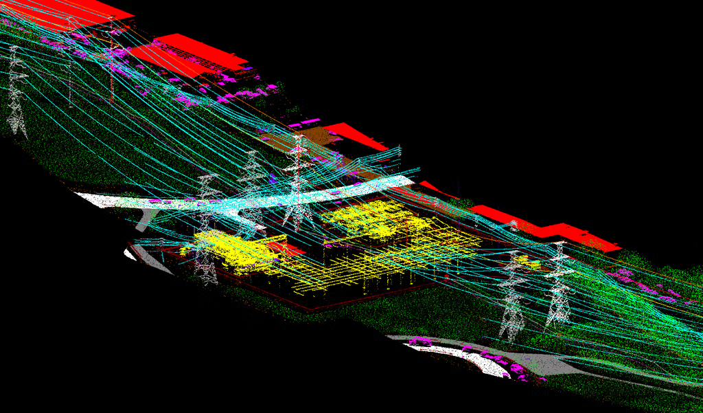
Combines satellite imagery, LiDAR, aerial imagery, weather, and utility records. Its AI models identify and forecast grow-in, fall-in, tree-health, and wildfire-related vegetation risks, with planning and field execution workflows.
Why shortlist it: Strong for large transmission and distribution networks that need broad coverage, predictive analytics, and end-to-end vegetation program optimization.
Website:

Builds a physics-based digital twin from LiDAR, imagery, GIS, and asset records. Models vegetation clearance and simulates the effects of wind, rainfall, temperature, and other conditions on network risk.
Why shortlist it: Particularly compelling when you need to move beyond proximity alerts and assess whether vegetation could threaten actual line clearances or network reliability under adverse conditions.
Website:

Analyzes LiDAR, satellite imagery, and other inspection imagery, then overlays vegetation findings on network asset maps. Predictive growth models help utilities identify risk-prone assets and optimize maintenance timing.
Why shortlist it: Worth evaluating for utilities that need vegetation analytics integrated with an established grid asset model and existing utility software workflows.
Website:
| Capability | LiveEO Treeline | AiDASH IVMS | Neara | GE Vernova GridOS |
|---|---|---|---|---|
| Remote sensing and vegetation detection | Strong | Strong | Strong | Strong |
| Explicit risk scoring and ranking | Span-level | Predictive risk and work priority | Physics-based risk assessment | AI-based risk classification |
| Clearance and future-risk modeling | Risk classification and proximity | Growth and encroachment forecasting | Physics-based scenario simulation | Predictive growth modeling |
| Work planning and execution | Work orders and QA | Planning and field workflows | Prioritized work plans | Maintenance workflows |
| Best differentiator | Span prioritization | Network-wide intelligence | Engineering-level simulation | Utility ecosystem integration |
Comparison is based on vendor-published capabilities, not independent benchmark testing. Confirm specific transmission features, integrations, and licensing with each vendor.
For a transmission line clearing program, the software should do more than flag vegetation close to a conductor. I would assess it against these six requirements:
Before choosing, run a pilot on a representative transmission corridor with known encroachments and historical vegetation-related outages. Compare each platform's rankings against actual field inspections, clearance violations, and outage records. Measure detection accuracy, high-risk hazards missed, lead time before clearance breach, and expected risk reduction per dollar spent.
One question that would help narrow this down: Are your remote-sensing inputs primarily airborne LiDAR point clouds, satellite imagery, or a combination of LiDAR and aerial imagery? That will materially affect which platform is the strongest fit for your workflow.
