Data as of Sep 18, 2026 · Based on 48 AI responses from ChatGPT Search and Google AI Mode · See how Parse measures this
Your brand can be here too.
Source | Citation share |
|---|---|
 CropX Agronomic Farm Management Systemhttps://cropx.com/ | 3.3% |
 Farm Monitoring System with Drones and Optical Camera Communicationhttps://pmc.ncbi.nlm.nih.gov/articles/PMC11436120/ | 2.0% |
 Sentera FieldAgenthttps://sentera.com/fieldagent/ | 2.0% |
Farm Data Connectivity - Connect the dotshttps://cropx.com/cropx-system/farm-data-connectivity/ | 1.8% |
 9 Best Crop Monitoring Software Platforms | Cropaiahttps://cropaia.com/blog/best-crop-monitoring-software-platforms/ | 1.0% |
 Crop Monitoring Software For Remote Farm Analyticshttps://eos.com/products/crop-monitoring/ | 1.0% |
 Agremohttps://www.agremo.com/ | 1.0% |
 Which Are the Top Digital Farming Companies in 2026?https://www.marketgrowthreports.com/blog/digital-farming-companies-485 | 1.0% |
TerraViewhttps://www.terraview.io/about | 1.0% |
 AI Crop Monitoring & Variable Rate Applications | Webinarhttps://www.youtube.com/watch | 1.0% |
If you want **one system that combines drones + field sensors + cameras + weather**, I’d shortlist these rather than treating drone software and farm-management software as the same thing: Platform | Best fit | Drones | Sensors/weather | Cameras | Data integration --- | --- | --- | --- | --- | ---
If you want one system that combines drones + field sensors + cameras + weather, I’d shortlist these rather than treating drone software and farm-management software as the same thing:
| Platform | Best fit | Drones | Sensors/weather | Cameras | Data integration |
|---|---|---|---|---|---|
| CropX | Irrigation, soil, crop health | ◐ | Excellent | ◐ | Excellent |
| Sentera FieldAgent | Drone/imagery-heavy crop scouting | Excellent | ◐ | Excellent | Good |
| Terra | Existing mixed hardware / custom sensor fusion | Yes | Yes | Yes | Excellent |
| Pix4Dfields | Professional drone mapping/analysis | Excellent | Limited | Excellent | Good |
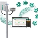
CropX is particularly interesting if your goal is to correlate what's happening in the soil with what's happening above ground. It combines soil sensors, ET sensors, rain gauges, weather stations, satellite imagery, machinery data and agronomic management in one system. It also supports third-party sensors and equipment integrations.
Its hardware includes multi-depth soil sensing, weather, rainfall and telemetry, while the software covers irrigation, disease, nutrition and crop monitoring.
Choose it if: irrigation/water management and continuous field sensing are central.
FieldAgent is much more imagery-centric. It can ingest drone, satellite and ground imagery, plan drone missions, process imagery and generate measurements such as stand counts, canopy cover and crop-health information. It also integrates with systems including John Deere Operations Center and Climate FieldView.
Choose it if: drones are going to be your primary scouting/measurement tool and you need repeatable high-resolution imagery.
Terra is designed specifically around connecting heterogeneous existing equipment rather than forcing you into one hardware ecosystem. Its platform advertises connections to cameras, sensors, weather stations, drones, gateways and farm APIs, with MQTT, RTSP/ONVIF, REST/webhooks and imports. It then applies data normalization, computer vision and sensor fusion.
Choose it if: you already have a mixture of cameras, IoT sensors, weather stations and drone systems and want a common intelligence layer.
Pix4Dfields is more of a drone mapping/remote-sensing component than a complete farm operating system. It supports RGB and multispectral drone imagery and is designed for rapid field processing and mapping.
Choose it if: you want sophisticated drone/multispectral mapping and are comfortable connecting that output to another farm platform.
For a serious deployment, I'd avoid making the drone platform responsible for everything:
Drones/cameras → imagery layer Soil/weather/IoT → sensor layer Farm equipment → machinery layer ↓ Central farm data platform → analytics/AI → alerts, maps and recommendations
That's important because recent agricultural-monitoring research emphasizes the value of multi-temporal, multi-sensor fusion rather than relying on a single data source.
So, broadly:
If you tell me farm size, crop type, whether you already own drones/sensors/cameras, and whether you need autonomous alerts or just a dashboard, I can narrow this to a practical 2–3 platform architecture.
CropX is particularly interesting if your goal is to correlate what's happening in the soil with what's happening above ground. It combines soil sensors, ET sensors, rain gauges, weather stations, satellite imagery, machinery data and agronomic management in one system. It also supports third-party sensors and equipment integrations.
Its hardware includes multi-depth soil sensing, weather, rainfall and telemetry, while the software covers irrigation, disease, nutrition and crop monitoring.
Choose it if: irrigation/water management and continuous field sensing are central.
FieldAgent is much more imagery-centric. It can ingest drone, satellite and ground imagery, plan drone missions, process imagery and generate measurements such as stand counts, canopy cover and crop-health information. It also integrates with systems including John Deere Operations Center and Climate FieldView.
Choose it if: drones are going to be your primary scouting/measurement tool and you need repeatable high-resolution imagery.
Terra is designed specifically around connecting heterogeneous existing equipment rather than forcing you into one hardware ecosystem. Its platform advertises connections to cameras, sensors, weather stations, drones, gateways and farm APIs, with MQTT, RTSP/ONVIF, REST/webhooks and imports. It then applies data normalization, computer vision and sensor fusion.
Choose it if: you already have a mixture of cameras, IoT sensors, weather stations and drone systems and want a common intelligence layer.
Pix4Dfields is more of a drone mapping/remote-sensing component than a complete farm operating system. It supports RGB and multispectral drone imagery and is designed for rapid field processing and mapping.
Choose it if: you want sophisticated drone/multispectral mapping and are comfortable connecting that output to another farm platform.
For a serious deployment, I'd avoid making the drone platform responsible for everything:
Drones/cameras → imagery layer Soil/weather/IoT → sensor layer Farm equipment → machinery layer ↓ Central farm data platform → analytics/AI → alerts, maps and recommendations
That's important because recent agricultural-monitoring research emphasizes the value of multi-temporal, multi-sensor fusion rather than relying on a single data source.
Combining aerial drone data, in-ground/fixed sensors, security/monitoring cameras, and localized weather metrics into a single ecosystem requires an **integrated farm management platform (FMSP)** or an interoperable software stack. Because no single hardware manufacturer builds every single component natively, the…
Combining aerial drone data, in-ground/fixed sensors, security/monitoring cameras, and localized weather metrics into a single ecosystem requires an integrated farm management platform (FMSP) or an interoperable software stack. Because no single hardware manufacturer builds every single component natively, the "best" platforms are those with open APIs or extensive partner networks that act as a central digital dashboard.
Top platforms and ecosystems capable of unifying these diverse data streams include:
To help narrow down the ideal setup, could you tell me:
Combining drones, IoT ground sensors, security/field cameras, and microclimate/weather data into a single coherent dashboard requires an ecosystem approach. While few single software tools manufacture all the hardware, several premier **Farm Management Information Systems (FMIS)** and **ag-tech platforms** specialize…
Combining drones, IoT ground sensors, security/field cameras, and microclimate/weather data into a single coherent dashboard requires an ecosystem approach. While few single software tools manufacture all the hardware, several premier Farm Management Information Systems (FMIS) and ag-tech platforms specialize in cross-platform data fusion.
The top platforms capable of bridging these multi-source data streams are organized below by their operational strengths:
To help narrow down the ideal stack, let me know:
For a **single farm-monitoring stack**, I’d shortlist: - **Climate FieldView** — strongest overall for row-crop operations: combines field/equipment data, imagery, weather and scouting workflows. [AI Tool…
For a single farm-monitoring stack, I’d shortlist:
My preferred architecture: CropX (sensors/weather) + PIX4Dfields (drones/cameras) + FieldView or your existing farm-management system as the operational hub. No single platform is currently best-of-breed across all four data sources.
Combining aerial drone data, Internet of Things (IoT) ground sensors, fixed surveillance/security cameras, and local weather forecasting into a single cohesive dashboard requires an enterprise-grade Farm Management Information System (FMIS) or an interoperable AgTech ecosystem. The top platforms capable of bridging…
Combining aerial drone data, Internet of Things (IoT) ground sensors, fixed surveillance/security cameras, and local weather forecasting into a single cohesive dashboard requires an enterprise-grade Farm Management Information System (FMIS) or an interoperable AgTech ecosystem.
The top platforms capable of bridging these diverse data streams fall into a few key categories depending on your primary operational focus:
These platforms are designed to ingest third-party data from various hardware, weather APIs, and drone processing engines into one central command center.
If you are already invested in specific hardware, utilizing their native software suite often yields the tightest integration before exporting to a master dashboard.
If your ground sensors (soil moisture, NPK levels, microclimate weather stations) come from varied manufacturers (like Pessl Instruments/Metos, Davis Instruments, or proprietary LoRaWAN setups), look at middleware platforms like Farm21 or custom enterprise dashboards built on IoT brokers. They specialize in pulling clean soil and localized weather metrics alongside visual inputs.
To help narrow down the ideal platform, tell me:
No sources cited
If you want **one monitoring system that brings together drones, field sensors, cameras, and weather—not just farm bookkeeping—I’d shortlist these:** Platform | Best fit | Sensors/weather | Drone & imagery | Cameras | Overall --- | --- | --- | --- | --- | ---
If you want one monitoring system that brings together drones, field sensors, cameras, and weather—not just farm bookkeeping—I’d shortlist these:
| Platform | Best fit | Sensors/weather | Drone & imagery | Cameras | Overall |
|---|---|---|---|---|---|
| CropX | Best integrated agronomy platform | Excellent | Good via imagery/data integrations | Moderate | ⭐⭐⭐⭐⭐ |
| John Deere Operations Center | Large row-crop farms, especially Deere fleets | Good | Good | Limited | ⭐⭐⭐⭐½ |
| Climate FieldView | Crop imagery + agronomic analysis | Good | Good | Limited | ⭐⭐⭐⭐ |
| Sentera | Drone-based crop scouting | Moderate | Excellent | Limited | ⭐⭐⭐⭐ |
| Farmable | Specialty crops / simpler operations | Good | Moderate | Moderate via integrations | ⭐⭐⭐½ |
For your particular requirement, CropX is probably the closest match to a central monitoring platform. It combines soil sensors, weather stations, rain gauges, ET measurements, satellite/vegetation data, irrigation information and farm-machine data in one system. It can also ingest third-party sensors rather than forcing you into one hardware ecosystem.
That makes it particularly interesting if your architecture looks like:
Drone → crop imagery Cameras → visual/AI scouting Soil sensors → moisture/temp/EC Weather station → rain/wind/temp/humidity Machinery → application/planting/harvest data Satellite → broad field health ↓ CropX → unified agronomic picture + alerts/decisions
CropX also has dedicated soil, weather, rain and actual-ET hardware, so you can build a fairly cohesive sensor layer rather than stitching together dozens of vendors.
I'd look harder at Sentera or a dedicated drone-imagery platform alongside CropX. Drone systems are particularly useful for high-resolution scouting—spotting stressed plants, disease, irrigation problems, stand issues, etc.—while a platform like CropX is better at putting that information alongside soil, weather and irrigation conditions.
John Deere Operations Center becomes very compelling if you're already running Deere equipment. It excels at bringing machine locations, field operations, planting/application/harvest data and agronomic layers together.
I'd use it as the operational backbone and potentially add CropX for deeper soil/weather/irrigation monitoring.
This is where I'd avoid choosing a platform based solely on its marketing claim of "IoT integration." Cameras are usually the hardest component to integrate well. You want to establish whether the platform can ingest:
In other words, I'd favor an open integration architecture rather than expecting one vendor to manufacture every piece of hardware.
My recommended architecture for a serious farm-monitoring deployment would be: CropX + drone imagery + strategically placed field cameras + local weather stations + soil sensors, with the farm-management system sitting above them as the common data layer.
If you tell me farm size, crop(s), whether you already own drones/cameras/sensors, and whether this is row crop, orchard, vineyard, or livestock, I can narrow this to the 3 best platforms and show exactly what I'd deploy on the farm.
CropX also has dedicated soil, weather, rain and actual-ET hardware, so you can build a fairly cohesive sensor layer rather than stitching together dozens of vendors.
I'd look harder at Sentera or a dedicated drone-imagery platform alongside CropX. Drone systems are particularly useful for high-resolution scouting—spotting stressed plants, disease, irrigation problems, stand issues, etc.—while a platform like CropX is better at putting that information alongside soil, weather and irrigation conditions.
John Deere Operations Center becomes very compelling if you're already running Deere equipment. It excels at bringing machine locations, field operations, planting/application/harvest data and agronomic layers together.
I'd use it as the operational backbone and potentially add CropX for deeper soil/weather/irrigation monitoring.
Combining drones, IoT ground sensors, field cameras, and weather data into a single unified ecosystem requires an agtech platform with robust data ingestion APIs and multi-source analytics. No single hardware manufacturer does it all natively, but a few standout software ecosystems specialize in merging these data…
Combining drones, IoT ground sensors, field cameras, and weather data into a single unified ecosystem requires an agtech platform with robust data ingestion APIs and multi-source analytics. No single hardware manufacturer does it all natively, but a few standout software ecosystems specialize in merging these data streams effectively:
To help narrow down the ideal platform for your setup, let me know:
If you want **one system that actually brings drones + field sensors + cameras + weather together**, I’d focus less on traditional “farm management software” and more on **data-integration/agronomy platforms**. ### My shortlist Platform | Best fit | Drones / imagery | Sensors | Weather | Cameras / scouting | Overall
If you want one system that actually brings drones + field sensors + cameras + weather together, I’d focus less on traditional “farm management software” and more on data-integration/agronomy platforms.
| Platform | Best fit | Drones / imagery | Sensors | Weather | Cameras / scouting | Overall |
|---|---|---|---|---|---|---|
| cropx.com | Best overall for sensor-driven monitoring | Satellite; can ingest other data | Excellent | Excellent | Good | ⭐⭐⭐⭐⭐ |
| sentera.com | Best for drone/camera intelligence | Excellent | Some integration | Some | Excellent | ⭐⭐⭐⭐⭐ |
| pix4d.com | Best drone mapping/analytics layer | Excellent | Limited | Limited | Excellent | ⭐⭐⭐⭐ |
| deere.com | Large row-crop + machinery | Good | Good via ecosystem | Good | Moderate | ⭐⭐⭐⭐ |
| climate.com | Row crops + agronomic data | Good | Good via integrations | Excellent | Good | ⭐⭐⭐⭐ |
CropX is particularly interesting because it is designed around combining heterogeneous farm data, rather than just managing farm records. Its platform can ingest soil sensors, weather stations/rain gauges, third-party sensors, irrigation equipment, and machine data.
It also combines soil sensing, weather, satellite imagery, ET/water-stress monitoring and irrigation management in one dashboard.
I'd choose CropX if your primary questions are:
sentera.com is more imagery-centric. It handles drone, satellite and ground imagery and can turn that into analytics such as stand counts, canopy cover and crop-health information. It also supports planning drone missions and automated processing.
I'd choose it if you're building a serious drone/camera scouting operation and want imagery converted into measurable agronomic information rather than simply storing photos.
pix4d.com is particularly good at converting drone RGB/multispectral imagery into orthomosaics, vegetation-index maps, zones and prescription maps. It can also combine drone and satellite data and export information for farm machinery.
I would think of PIX4Dfields as the aerial-intelligence component, rather than the complete farm operating system.
If you're operating significant John Deere equipment, deere.com is very compelling. It connects field, machine, operator and agronomic data and provides near-real-time monitoring, including equipment location, yield and moisture information.
The downside is that it isn't really designed as a sensor + camera + drone aggregation platform first.
For a farm that genuinely wants “everything in one place,” I'd seriously consider:
Drones/cameras → Sentera or PIX4D → CropX → farm-management/machinery system
with:
Soil sensors + weather stations + irrigation + ET → CropX
and:
Drone RGB/multispectral + satellite imagery → Sentera/PIX4D → CropX or farm-management layer
That gives you a much more flexible architecture than trying to force one vendor to do everything.
If you tell me your farm size, crop(s), whether you already own drones/cameras/sensors, and whether you're using John Deere/Case/New Holland/etc., I can narrow this to the best 2–3 platforms and compare their integration capabilities and approximate costs.
If you want **one farm-monitoring system that pulls together drones, in-field sensors, cameras, and weather**, I’d shortlist these rather than buying four disconnected systems. Platform | Best for | Drones / imagery | Sensors & weather | Cameras | Overall --- | --- | --- | --- | --- | ---
If you want one farm-monitoring system that pulls together drones, in-field sensors, cameras, and weather, I’d shortlist these rather than buying four disconnected systems.
| Platform | Best for | Drones / imagery | Sensors & weather | Cameras | Overall |
|---|---|---|---|---|---|
| CropX | Best all-around agronomy platform | Satellite + imagery integrations | Excellent soil, ET, weather, rain, irrigation | Some image/scouting support | ⭐⭐⭐⭐⭐ |
| Sentera FieldAgent | Best drone/crop analytics | Excellent drone + multispectral imagery | More limited as a sensor hub | Imagery-centric | ⭐⭐⭐⭐½ |
| John Deere Operations Center | Best for machinery-heavy farms | Drone/satellite map layers | Strong machine/data integrations | Via connected ecosystem | ⭐⭐⭐⭐½ |
| DroneDeploy | Best aerial mapping workflow | Excellent drone mapping | Integrations rather than native sensor focus | Drone cameras | ⭐⭐⭐⭐ |
| Climate FieldView | Best field/machine data ecosystem | Imagery integrations | Weather + field data | Limited | ⭐⭐⭐⭐ |
CropX is probably the closest match to your description. It explicitly combines soil sensors, ET sensors, weather stations, rain gauges, satellite imagery, farm machinery and third-party sensors in one platform. It also provides irrigation, disease, nutrition and crop-monitoring insights.
The important distinction is that CropX is strongest at answering "What is happening to the crop/soil, and what should I do?"
Sentera's FieldAgent is much stronger if your priority is aerial imagery. It processes drone, satellite and ground imagery, with analytics such as stand counts, canopy cover, crop health and weed mapping.
I'd pair this with CropX if you want both aerial intelligence + root-zone/soil/weather intelligence.
John Deere Operations Center is compelling when your farm already has a substantial Deere fleet. It centralizes machine and work data, and its map-layer system can incorporate drone and satellite imagery, soil maps, topography and management zones.
For a serious monitoring setup, I wouldn't insist that one vendor provide every device. A better architecture is:
Drones/cameras → imagery platform → farm data platform ← soil/weather sensors → alerts & decisions
For example:
The key is data interoperability. CropX, for example, specifically supports third-party sensors, weather stations, irrigation equipment and machinery connections, including John Deere Operations Center.
If you tell me the farm size, crop(s), whether you're in the U.S., and roughly how much you'd like to spend, I can narrow this to a specific hardware + software stack and estimated annual cost.
The important distinction is that CropX is strongest at answering "What is happening to the crop/soil, and what should I do?"
Sentera's FieldAgent is much stronger if your priority is aerial imagery. It processes drone, satellite and ground imagery, with analytics such as stand counts, canopy cover, crop health and weed mapping.
I'd pair this with CropX if you want both aerial intelligence + root-zone/soil/weather intelligence.
John Deere Operations Center is compelling when your farm already has a substantial Deere fleet. It centralizes machine and work data, and its map-layer system can incorporate drone and satellite imagery, soil maps, topography and management zones.
When you are looking to unify aerial data (**drones**), **ground sensors** (soil moisture, IoT stations), **cameras** (scouting/fixed surveillance), and **weather intelligence** into a single pipeline, no single piece of hardware does it all. Instead, you need an integrated **Farm Management Information System…
When you are looking to unify aerial data (drones), ground sensors (soil moisture, IoT stations), cameras (scouting/fixed surveillance), and weather intelligence into a single pipeline, no single piece of hardware does it all. Instead, you need an integrated Farm Management Information System (FMIS) or an open-data ecosystem that links specialized aerial software with core agronomic analytics.
The top platforms capable of handling or bridging these multi-layered data streams include:
- **Best for:** High-resolution aerial mapping, multispectral crop health tracking, and seamless enterprise data-sharing.
- **Integration Strengths:** DroneDeploy natively links with platforms like Climate FieldView . You can pipe high-resolution orthomosaics, plant health (NDVI), and elevation maps straight into core agronomic management software, combining drone flight logs with machinery and yield data.[](https://www.dronedeploy.com/product/market/uycmnmnnrtbfxikdfwvk) [[1]](https://www.dronedeploy.com/product/market/uycmnmnnrtbfxikdfwvk)[[2]](https://www.youtube.com/watch?v=yRehRUzwS4k)

- **Best for:** Comprehensive field data visualization, seed/fertility scripting, and weather integration.
- **Integration Strengths:** Acts as a central hub for equipment, agronomic mapping, and localized weather tracking. While it doesn't process raw drone imagery natively out-of-the-box, its robust API and direct integration with aerial mapping software (like DroneDeploy) makes it an industry standard for centralizing what happens in the field.[](https://www.dronedeploy.com/product/market/uycmnmnnrtbfxikdfwvk) [[1]](https://www.dronedeploy.com/product/market/uycmnmnnrtbfxikdfwvk)

- **Best for:** Deep analytics bridging aerial sensor payloads (multispectral/thermal) and agronomic decision-making.
- **Integration Strengths:** Sentera specializes in translating raw sensor data from drone flights into block-level analytics. It heavily supports integration with major machinery and ag-tech networks (such as John Deere's Operations Center), allowing localized weather and scouting observations to drive variable-rate prescriptions.[](https://www.youtube.com/watch?v=rF-hvqbDssY&t=489) [[1]](https://www.youtube.com/watch?v=rF-hvqbDssY&t=489)[[2]](https://www.youtube.com/watch?v=7bDLZRUXwIY&t=616)

- **Best for:** Full-spectrum farm financials, water/irrigation management, and mixed-fleet machinery tracking.
- **Integration Strengths:** Trimble is built for heavy operational data management. It easily ingests IoT ground sensor data, weather data layers, and maps from various scouting platforms, turning multi-source inputs into actionable work orders and compliance tracking.
To help narrow down the ideal architecture for your operation, tell me: